Civil
Civil

Rainbow
Dec 21, 2005Rainbows are awesome. Have you ever looked at them right after it rains, or through the water outside? Well, I have and I think that they are interesting.A rainbow is an arch of light showing the colors of the light spectrum. The colors are seen in order with red on the outside, followed by orange, yellow, green, blue, indigo, and violet.
Rainbows are caused by drops of water that are falling through the air. They are usually seen in the sky opposite to the sun at the end of a shower. They can also be seen in the spray of waterfalls.
When the sunlight enters a raindrop it is bent by and reflected from the drop. When this happens the light appears as a spectrum of colors. But, the colors can only be seen when the angle of reflection between the sun, the water drop, and the observer's line of version is between 40 degrees and 42 degrees.
The rainbow appears high when the sun is low in the sky, the rainbow is lower, when the sun is higher. When the sun is up higher than 42 degrees above the horizon, a rainbow cannot be seen because the required angle passes over the head of the observer. Do you think that the rainbows in the pictures are pretty and neat? I hope so!
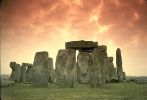
Stonehenge
Dec 21, 2005Stonehenge. You may have heard of it, you may not have. Stonehenge in considered by many to be an important landmark in space and time. We will many thousands of years back in time to explore this great monument. Anyone who visits Stonehenge will probably be confused, and with good reason! They will have come through the car parking tunnel and then across a path, and they may not notice that they have just crossed the line of a bank, a ditch, and a ring of white concrete markers. They will probably be either staring up at the soaring stones above them or at the jumble of rocks at their feet.
"Who built it and why?" they will ask. People have wondered about Stonehenge for hundreds of years. We wonder who built it. Stonemasons wonder how the stones were cut to their rectangular shape. Engineers wonder how the stones were dragged to the site and placed upright. Jewelry and tools have been found near Stonehenge. Archeologists wonder at these. They wonder who made these things and who they made them for.
Anthropologists, too, wonder. What were the people like? Were they farmers, or did they hunt? Were they friendly, or war like? Some people believe that the people who built Stonehenge, were, as they say, Stone age Einsteins!
Now, you may ask, why was it built? Well, we're not exactly sure, but many think that its main purpose was to be used as some kind of calender. It marked important astrological events. It may also have had a religious purpose.
In the 1950's, archaeologists began excavations at Stonehenge. These proved that Stonehenge was built in three main stages from 2800 to 1500 B.C. Over the many years between then and now, many of the stones fell or were dragged away to be used as bridges or dams. Scholars have learned what Stonehenge really looked like because of the stones remaining. This is a photograph of Maryhill Stonehenge, a monument built by Sam Hill as a tribute to soldiers who fought and died in World War I. It is a life-size replica of the original Stonehenge.
A wall of earth, 320 feet in diameter, surrounded Stonehenge.
Inside of the wall, thirty blocks of sandstone each 13 1/2 feet or 4 meters above the ground and weighing about 28 tons average, stand. On top, stones were placed end to end, balancing in a perfect circle. Then came 60 blue stones, about 4 tons average. Inside of this, 2 horse shoe forms were built, one inside of the other. A stone, 76 feet tall, stands 80 yards, or 73 meters, to the east of Stonehenge. This was put up in the first stage of building.
Some people think that it took 30,000 hours as well as hundreds of years to complete Stonehenge.
The British government began to restore Stonehenge not long ago, so now many generations can wonder at Stonehenge.

The Great Barrier Reef Coral
Dec 21, 2005 The Great Barrier Reef is actually a series of smaller reefs. Reefs form under water and can be made of coral, sand, or rock. The top of the reef sits about two to three feet below sea level. Coral reefs are found in warm, shallow, clean water. The Great Barrier Reef is the largest reef of all, stretching an amazing 1,250 miles, or 2,000 kilometers, across the blue of the ocean. It forms a natural break water between the strong waves of the Pacific and the coast of Australia. It's location is in the Coral Sea, the area of the Pacific close to Australia's northeastern coast. The waters around it cover roughly 80,000 square miles, or 208,000 kilometers, an area slightly smaller than the state of Minnesota.Reefs may be found as deep as 250 feet below the surface. Corals that grow below 150 feet don't make very good reef builders.
There are three different groups in which all reefs are classified. The first reef type is called a Fringing reef. This reef is formed as coral grows in the shallow waters along the shores of land. A barrier reef, such as the Great Barrier reef, grows some distance from the shore before coming close to the surface. A lagoon separates the barrier reef from the shore. An Atoll reef is a circular reef, usually with a lagoon in the center. The waves of the lagoon cover a submerged island. The reef grows in layers over the island.
There are many islands on the Great Barrier reef made of coral sand that has piled up to make islands. Coral sand is formed when waves constantly wash over the dead coral, breaking it in to sand. These islands have been given the name Coral Cays. Most Coral Cays are impossible to reach by boat. They are hard to see, and the sharp coral can tear out the bottom of a boat. Ancient shipwrecks can still be found among the coral!
Reefs as large as the Great Barrier Reef take thousands of years to develop. If you happen to visit a reef, any reef, be careful to not step on living coral. Most grow slowly, maybe less than two inches, or five centimeters a year. It would take years to replace it!
About three hundred fifty types of coral live and grow on the Great Barrier Reef. All have different skeleton shapes. One kind of coral looks like deer antlers! It is called staghorn coral, and is one of the more common corals on the reef. It is also one of the fastest growers. It can grow up to 4 inches, or 10 centimeters, a year!
Not only do the corals make up the reef itself, but they are home to many different creatures. Many types of fish depend on the coral to protect them.
Hundreds of miles along the reef have not been explored, but of what has, the beauty is breath taking!
1 comments
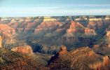
The Grand Canyon
Dec 21, 2005The Grand Canyon is located in the northwest part of Arizona.The Grand Canyon was made by the cut of running water. The Colorado River flows through the canyon. Some people think the Colorado River was there to start with and that over the years it cut through the rock, and now it is still there.
If you look in the canyon, you can see many layers of rock.
Geologists believe these rocks are at least two billion years old, which is almost certainly true, but no one can be exact.
About 500 million years ago, tiny sea creatures called trilobites lived in the sea. When they died, minerals from the ocean replaced their cells in their bodies. Then a long time after, the bodies petrified, they were fossils. There are no fossils at the bottom of the canyon, but near the top, you can find trilobites, and sometimes even footprints or so of reptiles.
Hiking in the Grand Canyon is very different from any other hiking because of its dry climate. Rangers say you need at least three liters of water for going down the canyon per day (remember, this is per person). You need less water in the winter, but you have to watch for freezing cold, rain, sleet or snow. You shouldn't have bare skin and in the summer you should wear light clothes and a hat. You should hike in the coolest part of the day and rest in shade at mid-day.
The weather is, well, very odd. In the middle of the canyon it gets very hot and dry. On the North Rim it is like the mountains. On the South Rim, it's a mixture of hotness and mountain-like. And canyon walls are pretty dry.
Three bridges cross the river: The Navajo, (used for vehicles) and two suspension bridges. Until 1907, the only way to cross the river was by a ferry. Later on, E.D. Wolly made a trail from the North to South rim. In 1921, they built a swinging bridge.
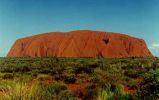
![uluruclose uluruclose[1].jpg](http://hamaraphotos.com/albums300/userpics/10628/thumb_uluruclose%5B1%5D.jpg)
uluruclose
Dec 21, 2005Climbing Uluru - The local indigenous community request that visitors respect the sacred status of Uluru by not climbing the rock, with signs posted to this effect. In 1983 the former Prime Minister of Australia, Bob Hawke, promised to respect the request from the community that climbing Uluru be prohibited, but broke his promise when title was handed to the traditional owners in 1985 because access for tourists to climb Uluru was made a condition before they could receive the title. The climb crosses an important dreaming track, which has been a cause of sadness and distress among traditional owners. Neverthless, they are unable to prohibit climbing, and climbing Uluru is a popular attraction for a large fraction of the many tourists who visit it each year. A rope handhold makes the climb easier, but it is still quite a long and steep climb and many intended climbers give up partway up. There are several deaths a year as a direct result of climbing the rock, mainly from heart failure. The Rock is arkose, a course-grained sandstone rich in feldspar at least 2.5 km thick. Uplifting and folding between 400-300 mya turned the sedimentary layers nearly 90 degrees to their present position. The surface has then been eroded.
Depending on the time of day and the atmospheric conditions, the rock can dramatically change color, anything from blue to violet to glowing red ! Many avid photographers set up for days and record the many changing colors of Uluru.
![ulurutop ulurutop[1].jpg](http://hamaraphotos.com/albums300/userpics/10628/thumb_ulurutop%5B1%5D.jpg)
ulurutop
Dec 21, 2005Uluru (also Ayers Rock or The Rock) is a large rock formation in central Australia, in the Northern Territory. It is located in Uluru-Kata Tjuta National Park, 350 km southwest of Alice Springs at 25 degrees 20' 41" S 131 degrees 01' 57" E. It is the second-largest monolith in the world (after Mount Augustus, also in Australia), more than 318 m (986 ft) high and 8 km (5 miles) around. It also extends 2.5 km (1.5 miles) into the ground. It was described by explorer Ernest Giles in 1872 as "the remarkable pebble". Kata Tjuta National Park is owned and run by the local Aboriginals. The Australian government handed ownership of the land back to the Aboriginals some years ago.
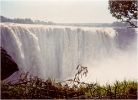
The Victoria Falls
Dec 21, 2005 One of the greatest waterfalls in the whole world lies on the Zimbezi River, which forms the border between Zambia and Zimbabwe. Some people think it is one of the most beautiful sights in the world! Upstream, the river flows through a wide valley. You could probably see Victoria Falls from 25 to 40 miles away, and see its spray rising 1,000 feet into the air from seven miles away! Long before you even see the waterfalls you can hear the roaring of the water! The native people call it "mosi-oa-tunya" which means "smoke that thunders." The falls were formed by a deep rift in the rock that lies directly across the path of the Zimbezi River. The rift was caused by movement of the earth about 150 million years ago. At the broadest point, the falls are 5,545 feet across. The height of the falls varies from 256 feet to about 354 feet in the center.Victoria falls was discovered by David Livingstone in 1855. The falls were named in honor of Queen Victoria.
There is no wonder Victoria Falls is a Wonder of The Natural World!
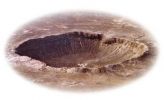
The Barringer Meteor Crater
Dec 21, 2005 WHAT IS THE BARRINGER METEORITE CRATER?
The Barringer Meteorite Crater (also known as "Meteor Crater") is a gigantic hole in the middle of the arid sandstone of the Arizona desert. A rim of smashed and jumbled boulders, some of them the size of small houses, rises 150 feet above the level of the surrounding plain. The crater itself is nearly a mile wide, and 570 feet deep.
When Europeans first discovered the crater, the plain around it was covered with chunks of meteoritic iron - over 30 tons of it, scattered over an area 8 to 10 miles in diameter.
David Roddy, USGS.
HOW DO WE KNOW WHAT MADE IT?
The process of scientific discovery involves the development of hypotheses, tentative explanations which may or may not account for the observable facts. A good scientific hypothesis will generate a number of logical consequences or predictions, which are capable of being tested directly. Ultimately, the hypothesis will be accepted as valid only if:
repeated tests of these predictions, by different investigators, tend to confirm it;
it is consistent with other well-confirmed hypotheses;
it is more useful than other hypotheses in accounting for a broad range of observed facts; and
it is more economical or "elegant" than other hypotheses, in the sense of requiring fewer additional assumptions.
Although meteorite falls had been reported for thousands of years, until this century no one had ever identified a crater created by such a fall. Even a meteorite as large as the 66-ton Hoba, the largest ever discovered, may be slowed so much by the Earth's atmosphere that it lands without making a significant hole.
In 1891 Grove Karl Gilbert, then chief geologist for the U.S. Geological Survey, decided to test two conflicting hypotheses about the crater. The first was that the crater was created by the impact of a giant meteorite; the second, that it was the result of an explosion of superheated steam, caused by volcanic activity far below the surface.
If an iron meteorite had created the crater, Gilbert assumed that it would have had to be nearly as big as the crater itself. So what predictions could he test?
First, the meteorite should be taking up a lot of space in the hollow of the crater. The volume of the hollow would therefore be less than the volume of the ejected material in the crater rim. Second, the presence of a large mass of buried iron should affect the behavior of magnets and compass needles. Neither prediction was confirmed. Gilbert concluded that a steam explosion was the only surviving hypothesis, in spite of the fact that no volcanic rocks had ever been found in the area. The meteorites around the crater were simply a coincidence.
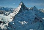
The Matterhorn
Dec 21, 2005An English mountaineer, Edward Whymper, led the first successful climb to the top of the Matterhorn in 1865. That first climb turned out to be really sad. Out of seven, four people died when a rope snapped and they plunged down the north face. One of the bodies was never found.The Matterhorn is well known for it's magnificent outline and it's position above the Swiss village of Zermatt. If you've visited Disney Land in California you have no doubt seen a replica of it.
The Matterhorn is not the highest mountain in the Alps, or even the highest peak in Switzerland, but it has four very marked ridges and faces that make it look like a pyramid. Its beauty is made even more striking by the way it stands by no other mountain close by.
About 40 million years ago, the Alps were created, when two sections of the Earth's crust crashed into each other, throwing up rock into a chain of buckled, folded mountains.

Mount Everest
Dec 21, 2005Mount Everest is one of the tallest mountains in the world. It is part of the Himalayan Mountains. They were formed in the last few million years. After the supercontinent of Laurasia broke up millions of years ago, India moved slowly north towards Asia and then crashed into it. The seabed between the two plates (the earth's crust is divided into large areas of land called plates) was crumbled and pushed up on the northern rim of India to form mountains. These two plates of the earth's crust are still moving, so the Himalayas are being pushed up higher.The highest mountain on the planet, Mount Everest is growing two inches taller each year. Satellite technology says the mountain is currently 29,107 feet tall. First recognized as the highest peek in 1852, it got its western name ten years later in 1862. Mount Everest was named for Sir George Everest (1790-1866), a British surveyor. Surveyors don't agree on the height of Mount Everest. The British government in the 1800's thought the height was 29,002 feet. In 1954 the Indian government said it's 29,028 feet, but a widely used unofficial figure says it is 29,141 feet!
Mount Everest sits on the border between Nepal and Tibet.
People from the western hemisphere weren't allowed to climb Mount Everest until the early 1920's. The first known climb that made it to the top was made by a New Zealander named Edmund Hillary and a Napalese named Tenzing Norgay. They climbed the mountain in 1953. Since then Everest has been climbed by 400 people. Access is restricted by the Nepalese to prevent too much damage to the environment.
Mount Everest is 97 degrees below freezing, talk about cold!
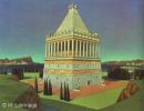
The Mausoleum of Halicarnassus
Dec 21, 2005Similar to the Great Pyramid, we are now visiting the burial place of an ancient king. Yet the Mausoleum is different - so different from the Pyramid that it earned its reputation - and a spot within the list - for other reasons. Geographically, it is closer to the Temple of Artemis... And it was the beauty of the tomb rather than its size that fascinated its visitors for years. Location
In the city of Bodrum (f.k.a. Halicarnassus) on the Aegean Sea, in south-west Turkey.
History
When the Persians expanded their ancient kingdom to include Mesopotamia, Northern India, Syria, Egypt, and Asia Minor, the king could not control his vast empire without the help of local governors or rulers -- the Satraps. Like many other provinces, the kingdom of Caria in the western part of Asia Minor (Turkey) was so far from the Persian capital that it was practically autonomous. From 377 to 353 BC, king Mausollos of Caria reigned and moved his capital to Halicarnassus. Nothing is exciting about Maussollos life except the construction of his tomb. The project was conceived by his wife and sister Artemisia, and the construction might have started during the king's lifetime. The Mausoleum was completed around 350 BC, three years after Maussollos death, and one year after Artemisia's.
For 16 centuries, the Mausoleum remained in good condition until an earthquake caused some damage to the roof and colonnade. In the early fifteenth century, the Knights of St John of Malta invaded the region and built a massive crusader castle. When they decided to fortify it in 1494, they used the stones of the Mausoleum. By 1522, almost every block of the Mausoleum had been disassembled and used for construction.
Today, the massive castle still stands in Bodrum, and the polished stone and marble blocks of the Mausoleum can be spotted within the walls of the structure. Some of the sculptures survived and are today on display at the British Museum in London. These include fragment of statues and many slabs of the frieze showing the battle between the Greeks and the Amazons. At the site of the Mausoleum itself, only the foundation remains of the once magnificent Wonder.

The Temple of Artemis
Dec 21, 2005Is it simply a temple? How could it take its place among other unique structures such as the Pyramid, the Hanging Gardens, and the Colossus of Rhodes? For the people who actually visited it, the answer was simple. It was not just a temple... It was the most beautiful structure on earth... It was built in honor of the Greek goddess of hunting, wild nature, and fertility. That was the Temple of Artemis at Ephesus. Location
The ancient city of Ephesus near the modern town of Selcuk, about 50 km south of Izmir (Smyrna) in Turkey.
History
Although the foundation of the temple dates back to the seventh century BC, the structure that earned a spot in the list of Wonders was built around 550 BC. Referred to as the great marble temple, or temple D, it was sponsored by the Lydian king Croesus and was designed by the Greek architect Chersiphron. The Temple was decorated with bronze statues sculpted by the most skilled artists of their time: Pheidias, Polycleitus, Kresilas, and Phradmon.
The temple served as both a marketplace and a religious institution. For years, the sanctuary was visited by merchants, tourists, artisans, and kings who paid homage to the goddess by sharing their profits with her. Recent archeological excavations at the site revealed gifts from pilgrims including statuettes of Artemis made of gold and ivory... earrings, bracelets, and necklaces... artifacts from as far as Persia and India.
On the night of 21 July 356 BC, a man named Herostratus burned the temple to ground in an attempt to immortalize his name, which he did indeed. Oddly enough, Alexander the Great was born the same night. The historian Plutarch later wrote that the goddess was "too busy taking care of the birth of Alexander to send help to her threatened temple". And when Alexander the Great conquered Asia Minor, he offered to rebuild the destroyed temple, but the Temple was not restored until after his death in 323 BC. The temple was eventually restored and is labeled "Temple E" by archeologists.
When St Paul visited Ephesus to preach Christianity in the first century AD, he was confronted by the Artemis' cult who had no plans to abandon their goddess. And when the temple was again destroyed by the Goths in AD 262, the Ephesians vowed to rebuild. By the fourth century AD, most Ephesians had converted to Christianity and the temple lost its religious glamor. The final chapter came when in AD 401 the Temple of Artemis was torn down by St John Chrysostom. Ephesus was later deserted, and only in the late nineteenth century has the site been excavated. The digging revealed the temple's foundation and the road to the now swampy site. Attempts were recently made to rebuilt the temple, but only a few columns have been re-erected.
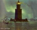
The Lighthouse of Alexandria
Dec 21, 2005Of the Seven Wonders of the Ancient World, only one had a practical use in addition to its architectural elegance: The Lighthouse of Alexandria. For sailors, it ensured a safe return to the Great Harbor. For architects, it meant even more: it was the tallest building on Earth. And for scientists, it was the mysterious mirror that fascinated them most... The mirror which reflection could be seen more than 50 km (35 miles) off-shore. Location
On the ancient island of Pharos, now a promontory within the city of Alexandria in Egypt.
History
Shortly after the death of Alexander the Great, his commander Ptolemy Soter assumed power in Egypt. He had witnessed the founding of Alexandria, and established his capital there. Off of the city's coast lies a small island: Pharos. Its name, legend says, is a variation of Pharaoh's Island, but it is more likely that the name is Greek in origin. The island was connected to the mainland by means of a dike - the Heptastadion - which gave the city a double harbor. And because of dangerous sailing conditions and flat coastline in the region, the construction of a lighthouse was necessary.
The project was conceived and initiated by Ptolemy Soter around 290 BC, but was completed after his death, during the reign of his son Ptolemy Philadelphus. Sostratus, a contemporary of Euclid, was the architect, but detailed calculations for the structure and its accessories were carried out at the Alexandria Library/Mouseion. The monument was dedicated to the Savior Gods: Ptolemy Soter (lit. savior) and his wife Berenice. For centuries, the Lighthouse of Alexandria (occasionally referred to as the Pharos Lighthouse) was used to mark the harbor, using fire at night and reflecting sun rays during the day. It was even shown on Roman coins, just as famous monuments are depicted on currency today.
When the Arabs conquered Egypt, they admired Alexandria and its wealth. The Lighthouse continues to be mentioned in their writings and travelers accounts. But the new rulers moved their capital to Cairo since they had no ties to the Mediterranean. When the mirror was brought down mistakenly, they did not restore it back into place. In AD 956, an earthquake shook Alexandria, and caused little damage to the Lighthouse. It was later in 1303 and in 1323 that two stronger earthquakes left a significant impression on the structure. When the famous Arab traveler Ibn Battuta visited Alexandria in 1349, he could not enter the ruinous monument or even climb to its doorway.
The final chapter in the history of the Lighthouse came in AD 1480 when the Egyptian Mamelouk Sultan, Qaitbay, decided to fortify Alexandria's defense. He built a medieval fort on the same spot where the Lighthouse once stood, using the fallen stone and marble
The Colossus of Rhodes
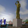
Dec 21, 2005Travelers to New York City harbor see a marvelous sight. Standing on a small island in the harbor is an immense statue of a robed woman, holding a book and lifting a torch to the sky. The statue measures almost one-hundred and twenty feet from foot to crown. It is sometimes referred to as the "Modern Colossus," but more often called the Statue of Liberty. This awe-inspiring statue was a gift from France to America and is easily recognized by people around the world. What many visitors to this shrine to freedom don't know is that the statue, the "Modern Colossus," is the echo of another statue, the original colossus that stood over two thousand years ago at the entrance to another busy harbor on the Island of Rhodes. Like the Statue of Liberty, this colossus was also built as a celebration of freedom. This amazing statue, standing the same height from toe to head as the modern colossus, was one of the Seven Wonders of the Ancient World.
The island of Rhodes was an important economic center in the ancient world. It is located off the southwestern tip of Asia Minor where the Aegean Sea meets the Mediterranean. The capitol city, also named Rhodes, was built in 408 B.C. and was designed to take advantage of the island's best natural harbor on the northern coast.
In 357 B.C. the island was conquered by Mausolus of Halicarnassus (whose tomb is one of the other Seven Wonders of the Ancient World), fell into Persian hands in 340 B.C., and was finally captured by Alexander the Great in 332 B.C.. When Alexander died of a fever at an early age, his generals fought bitterly among themselves for control of Alexander's vast kingdom. Three of them, Ptolemy, Seleucus, and Antigous, succeeded in dividing the kingdom among themselves.
The Rhodians supported Ptolemy (who wound up ruling Egypt) in this struggle. This angered Antigous who sent his son Demetrius to capture and punish the city of Rhodes.
The war was long and painful. Demetrius brought an army of 40,000 men. This was more than the entire population of Rhodes. He also augmented his force by using Aegean pirates.
The city was protected by a strong, tall, wall and the attackers were forced to use siege towers to try and climb over it. Siege towers were wooden structures often armed with catapults that could be moved up to a defender's walls to allow the attackers to scale them. While some were designed to be rolled up on land, Demetrius used a giant tower mounted on top of six ships lashed together to make his attack. This tower, though, was turned over and smashed when a storm suddenly approached. The battle was won by the Rhodians.
Demetrius had a second supertower built. This one stood almost 150 feet high and some 75 feet square at the base. It was equipped with many catapults and skinned with wood and leather to protect the troops inside from archers. It even carried water tanks that could be used to fight fires started by flaming arrows. This tower was mounted on iron wheels and could be rolled up to the walls.
When Demetrius attacked the city, the defenders stopped the war machine by flooding a ditch outside the walls and miring the heavy monster in the mud. By then almost a year had gone by and a fleet of ships from Egypt arrived to assist the city. Demetrius withdrew quickly leaving the great siege tower where it was.
To celebrate their victory and freedom, the Rhodians decided to build a giant statue of their patron god Helios. They melted down bronze from the many war machines Demetrius left behind for the exterior of the figure and the super siege tower became the scaffolding for the project. According to Pliny, a historian who lived several centuries after the Colossus was built, construction took 12 years. Other historians place the start of the work in 304 B.C..
The statue was one hundred and ten feet high and stood upon a fifty-foot pedestal near the harbor mole. Although the statue has been popularly depicted with its legs spanning the harbor entrance so that ships could pass beneath, it was actually posed in a more traditional Greek manner: nude, wearing a spiked crown, shading its eyes from the rising sun with its right hand, while holding a cloak over its left.
No ancient account mentions the harbor-spanning pose and it seems unlikely the Greeks would have depicted one of their gods in such an awkward manner. In addition, such a pose would mean shutting down the harbor during the construction, something not economically feasible.
Comparing the Statue of Liberty with the Colossus: Though the bodies are the same size the Statue stands higher because of the taller pedestal and upraised torch.
The statue was constructed of bronze plates over an iron framework (very similar to the Statue of Liberty which is copper over a steel frame). According to the book of Pilon of Byzantium, 15 tons of bronze were used and 9 tons of iron, though these numbers seem low. The Statue of Liberty, roughly of the same size, weighs 225 tons. The Colossus, which relied on weaker materials, must have weighed at least as much and probably more.
Ancient accounts tell us that inside the statue were several stone columns which acted as the main support. Iron beams were driven into the stone and connected with the bronze outer skin. Each bronze plate had to be carefully cast then hammered into the right shape for its location in the figure, then hoisted into position and riveted to the surrounding plates and the iron frame.
The architect of this great construction was Chares of Lindos, a Rhodian sculptor who was a patriot and fought in defense of the city. Chares had been involved with large scale statues before. His teacher, Lysippus, had constructed a 60-foot high likeness of Zeus. Chares probably started by making smaller versions of the statue, maybe three feet high, then used these as a guide to shaping each of the bronze plates of the skin.
It is believed Chares did not live to see his project finished. There are several legends that he committed suicide. In one tale he has almost finished the statue when someone points out a small flaw in the construction. The sculptor is so ashamed of it he kills himself.
In another version the city fathers decide to double the height of the statue. Chares only doubles his fee, forgetting that doubling the height will mean an eightfold increase in the amount of materials needed. This drives him into bankruptcy and suicide.
There is no evidence that either of these tales are true.
The Colossus stood proudly at the harbor entrance for some fifty-six years. Each morning the sun must have caught its polished bronze surface and made the god's figure shine. Then an earthquake hit Rhodes and the statue collapsed. Huge pieces of the figure lay along the harbor for centuries.
"Even as it lies," wrote Pliny, "it excites our wonder and admiration. Few men can clasp the thumb in their arms, and its fingers are larger than most statues. Where the limbs are broken asunder, vast caverns are seen yawning in the interior. Within it, too, are to be seen large masses of rock, by the weight of which the artist steadied it while erecting it."
It is said that an Egyptian king offered to pay for its reconstruction, but the Rhodians refused. They feared that somehow the statue had offended the god Helios, who used the earthquake to throw it down.
In the seventh century A.D. the Arabs conquered Rhodes and broke the remains of the Colossus up into smaller pieces and sold it as scrap metal. Legend says it took 900 camels to carry away the statue. A sad end for what must have been a majestic work of art
The statue of Zeus at Olympia
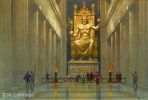
Dec 21, 2005This is the statue of the god in whose honor the Ancient Olympic games were held. It was located on the land that gave its very name to the Olympics. At the time of the games, wars stopped, and athletes came from Asia Minor, Syria, Egypt, and Sicily to celebrate the Olympics and to worship their king of gods: Zeus. Location
At the ancient town of Olympia, on the west coast of modern Greece, about 150 km west of Athens.
History
The ancient Greek calendar starts in 776 BC, for the Olympic games are believed to have started that year. The magnificent temple of Zeus was designed by the architect Libon and was built around 450 BC. Under the growing power of ancient Greece, the simple Doric-style temple seemed too mundane, and modifications were needed. The solution: A majestic statue. The Athenian sculptor Pheidias was assigned for the "sacred" task, reminiscent of Michelangelo's paintings at the Sistine Chapel.
For the years that followed, the temple attracted visitors and worshippers from all over the world. In the second century BC repairs were skillfully made to the aging statue. In the first century AD, the Roman emperor Caligula attempted to transport the statue to Rome. However, his attempt failed when the scaffolding built by Caligula's workmen collapsed. After the Olympic games were banned in AD 391 by the emperor Theodosius I as Pagan practices, the temple of Zeus was ordered closed.
Olympia was further struck by earthquakes, landslides and floods, and the temple was damaged by fire in the fifth century AD. Earlier, the statue had been transported by wealthy Greeks to a palace in Constantinople. There, it survived until it was destroyed by a severe fire in AD 462. Today nothing remains at the site of the old temple except rocks and debris, the foundation of the buildings, and fallen columns
The Hanging Gardens of Babylon
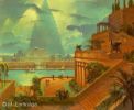
Dec 21, 2005Fruits and flowers... Waterfalls... Gardens hanging from the palace terraces... Exotic animals... This is the picture of the Hanging Gardens of Babylon in most people's minds. It may be surprising to know that they might have never existed except in the minds of Greek poets and historians! Location
On the east bank of the River Euphrates, about 50 km south of Baghdad, Iraq.
History
The Babylonian kingdom flourished under the rule of the famous King, Hammurabi (1792-1750 BC). It was not until the reign of Naboplashar (625-605 BC) of the Neo-Babylonian dynasty that the Mesopotamian civilization reached its ultimate glory. His son, Nebuchadnezzar II (604-562 BC) is credited for building the legendary Hanging Gardens. It is said that the Gardens were built by Nebuchadnezzar to please his wife or concubine who had been "brought up in Media and had a passion for mountain surroundings".
While the most descriptive accounts of the Gardens come from Greek historians such as Berossus and Diodorus Siculus, Babylonian records stay silent on the matter. Tablets from the time of Nebuchadnezzar do not have a single reference to the Hanging Gardens, although descriptions of his palace, the city of Babylon, and the walls are found. Even the historians who give detailed descriptions of the Hanging Gardens never saw them. Modern historians argue that when Alexander's soldiers reached the fertile land of Mesopotamia and saw Babylon, they were impressed. When they later returned to their rugged homeland, they had stories to tell about the amazing gardens and palm trees at Mesopotamia.. About the palace of Nebuchadnezzar.. About the Tower of Babel and the ziggurats. And it was the imagination of poets and ancient historians that blended all these elements together to produce one of the World Wonders.
It wasn't until the twentieth century that some of the mysteries surrounding the Hanging Gardens were revealed. Archaeologists are still struggling to gather enough evidence before reaching the final conclusions about the location of the Gardens, their irrigation system, and their true appearance. Some recent researchers even suggest that the Hanging Gardens were built by Senaherib, not by Nebuchadnezzar II (ca. 100 years earlier).
The Great Pyramid of Giza
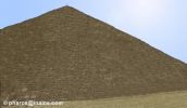
Dec 21, 2005It is the one and only Wonder which does not require a description by early historians and poets. It is the one and only Wonder that does not need speculations concerning its appearance, size, and shape. It is the oldest, yet it is the only surviving of the Seven Ancient Wonders. It is the Great Pyramid of Giza. Location:
At the city of Giza, a necropolis of ancient Memphis, and today part of Greater Cairo, Egypt. History
Contrary to the common belief, only the Great Pyramid of Khufu (Cheops), not all three Great Pyramids, is on top of the list of Wonders. The monument was built by the Egyptian pharaoh Khufu of the Fourth Dynasty around the year 2560 BC to serve as a tomb when he dies. The tradition of pyramid building started in Ancient Egypt as a sophistication of the idea of a mastaba or "platform" covering the royal tomb. Later, several stacked mastabas were used. Early pyramids, such as the Step Pyramid of King Zoser (Djoser) at Saqqara by the famous Egyptian architect, Imhotep, illustrate this connection.
The great pyramid is believed to have been built over a 20 year period. The site was first prepared, and blocks of stone were transported and placed. An outer casing (which disappeared over the years) was then used to smooth the surface. Although it is not known how the blocks were put in place, several theories have been proposed. One theory involves the construction of a straight or spiral ramp that was raised as the construction proceeded. This ramp, coated with mud and water, eased the displacement of the blocks which were pushed (or pulled) into place. A second theory suggests that the blocks were placed using long levers with a short angled foot.
Throughout their history, the pyramids of Giza have stimulated human imagination. They were referred to as "The Granaries of Joseph" and "The Mountains of Pharaoh". When Napoleon invaded Egypt in 1798, his pride was expressed through his famous quote: "Soldats! Du haut de ces Pyramides, 40 siècles nous contemplent". (Soldiers! From the top of these Pyramids, 40 centuries are looking at us)
Today, the Great Pyramid is enclosed, together with the other pyramids and the Sphinx, in the touristic region of the Giza Plateau. Also in the area is the museum housing the mysterious Sun Boat, only discovered in 1954 near the south side of the pyramid. The boat is believed to have been used to carry the body of Khufu in his last journey on earth before being buried inside the pyramid. It may also serve him as a means of transportation in his afterlife journey according to Ancient Egyptian beliefs.

Panama canal
Dec 21, 2005The history of the Panama Canal goes back to 16th century. After realizing the riches of Peru, Ecuador, and Asia, and counting the time it took the gold to reach the ports of Spain, it was suggested c.1524 to Charles V, that by cutting out a piece of land somewhere in Panama, the trips would be made shorter and the risk of taking the treasures through the isthmus would justify such an enterprise. A survey of the isthmus was ordered and subsequently a working plan for a canal was drawn up in 1529. http://www.eclipse.co.uk/~sl5763/panama.htm#History

